Our Surveying & Geospatial Services
Smart Survey & Planning provides end-to-end land surveying, mapping, and planning solutions with high-accuracy outputs. Using DGPS, Total Station, UAV/Drone systems, GIS platforms, and digital mapping tools, we deliver reliable data, clear insights, and professional reports for government and private sector projects.
Trusted Surveying for Smart Development
Since 2013, Smart Survey & Planning has been helping clients make confident decisions with precise survey data and customized geospatial deliverables. From DGPS boundary demarcation and Total Station surveys to drone mapping, cadastral & revenue surveys, contour/level surveys, and GIS development—our team ensures accuracy, transparency, and on-time reporting for projects of every scale.
Explore Our Services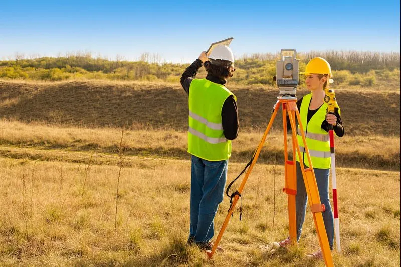
Total Station Survey
A high-precision ground survey used to measure angles, distances, and elevations for construction planning, land development, engineering layout, and topographic mapping. We deliver accurate site measurements with clear reporting and customized outputs.
DGPS Survey
Centimeter-level satellite-based positioning survey for boundaries, infrastructure, and government land records.
Contour & Level Survey
Mapping land slopes, elevation changes, and contours for drainage, roads, irrigation, and earthwork estimation.
Cadastral Survey
Precise measurement and legal mapping of land parcels for ownership verification and dispute prevention.
Drone Survey
UAV-based high-resolution aerial survey for fast mapping, 3D models, and elevation data.
Hydrographic Survey
Underwater survey measuring depths and features for irrigation, bridges, dredging, and flood studies.
GIS Mapping
Digital spatial data mapping and analysis for land use, utilities, assets, and planning.
Engineering & Infrastructure Survey
Precise survey services for roads, highways, canals, pipelines, bridges, and industrial projects.
Layout Planning
Optimized planning of plots, roads, utilities, and open spaces for compliant land development.
Asset Mapping
Digital mapping of utilities, roads, and physical assets for monitoring and management.
Construction Staking / Setting-Out
Accurate marking of foundations, columns, roads, and structures based on engineering drawings.
Renewable Energy Land Survey & Planning
Specialized land survey and planning consultancy for large-scale solar and wind energy projects.
As-Built Survey
Survey documenting actual constructed features for quality checks, billing, and facility management.
Volume & Earthwork Calculation
Precise cut-fill analysis and earthwork quantity calculation using drone and DGPS data.